If you picture hiking in France as Alpine climbs or dramatic Pyrenees trails, Alsace might surprise you.
Some of my favorite trails lead to medieval castle ruins, quiet fairytale-like towns, and sweeping views of the Vosges that feel far wilder than you’d expect.
One of the main reasons I moved to Alsace was for the hiking, and after exploring the region on foot in every season, I’ve found it to be one of the best places in the country for varied day hikes.
You can do an easy vineyard walk near Ribeauvillé, a castle hike above Colmar, or a steeper loop around Lac Blanc if you want more of a challenge.
Below, I’ll share the best hikes in Alsace for different ability levels, from easy walks to more demanding Vosges mountain hikes, along with practical details you need to plan your trip.
1. Circuit des Cerisiers
- Difficulty Level: Easy/Moderate
- Starting point: Aire de Jeux de Bischoffsheim
- Highest Point: 261 meters (856 feet)
- My Time: 2 hours 30 minutes
- Route length: 8.8 kilometers (5.4 miles)
- Accessible by Public Transport: Yes
- Google Map
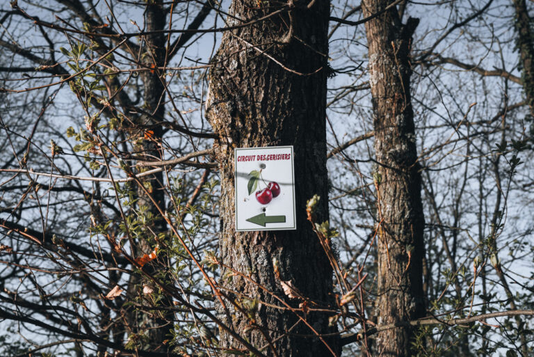
The Circuit des Cerisiers (Cherry Tree Circuit) is first on the list because it’s my go-to hike to kick off the hiking season.
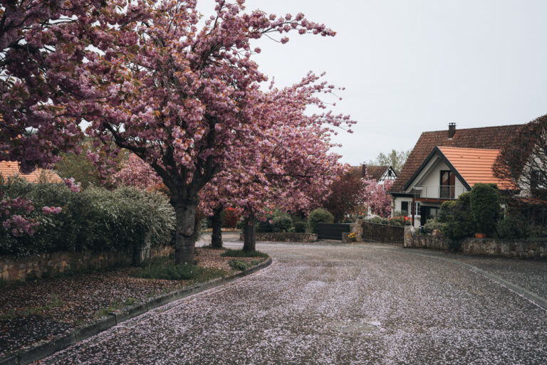
It’s relatively easy and goes through the picturesque cherry orchards of Alsace. I usually go around mid-April because that’s when the cherry trees are in full bloom.
Outside cherry blossom season, it’s more pleasant than unforgettable.
The trail is well-marked, but the first sign is not easy to find. It’s next to the playground in Bischoffsheim, which is at the edge of town.
Helpful Tip: The signs for this trail are small and easy to miss. Always double-check at turns.
Once you find the first marker, the rest of the trail is relatively easy to follow. You’ll pass by Obernai and the Couvent du Bischenberg before returning to Bischoffsheim.
The best area to spot cherry trees is along Allée des Cerisiers in Obernai. It’s an entire street lined with bright pink cherry trees.
2. Alsace Wine Route from Ribeauvillé to Riquewihr
- Difficulty Level: Easy
- Starting point: 1 Place de l’Ancien Hôpital, 68150 Ribeauvillé
- Highest Point: 240 meters (787 feet)
- My Time: 2 hours 30 minutes
- Route length: 5.3 kilometers (3.2 miles)
- Accessible by Public Transport: Yes
- Google Map
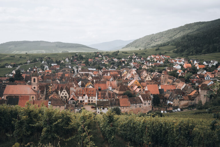
The Alsace Wine Route is famous for a reason, but you do not need a car to experience the best parts of it.
Several sections are easy to hike, and my favorite is between Ribeauvillé and Riquewihr.
To be completely honest, I consider this route more of a scenic vineyard walk than a true mountain hike.
The path is paved and has a few hills, but nothing like the other trails on this list.
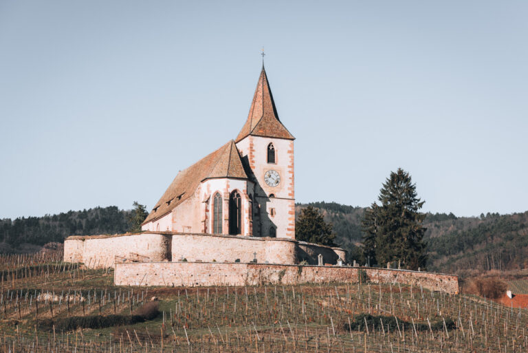
You’ll have sweeping views of the vines and a close-up look at Hunawihr’s fortified church without putting in a massive physical effort.
The only practical catch is that this is a point-to-point route rather than a loop.
Once you finish exploring Riquewihr, you have three easy options to get back: you can walk the same path in reverse, hop on the open-top Kutzig bus, or catch the local public bus directly back to Colmar.
If you want the highest possible scenic reward for the least amount of effort, this stroll through the vineyards is exactly what you need.
3. Hohlandsbourg Castle
- Difficulty Level: Moderate
- Starting point: St. Gilles, 68920 Wintzenheim
- Highest Point: 631 meters (2070 feet)
- My Time: 4 hours 30 minutes (with a visit to the castle)
- Route length: 12.4 kilometers (7.7 miles)
- Accessible by Public Transport: Yes
- Google Map
Helpful Tip: The map above starts in Turckheim, but you can save time by starting at the St. Gilles bus stop (Line B from Colmar’s train station).
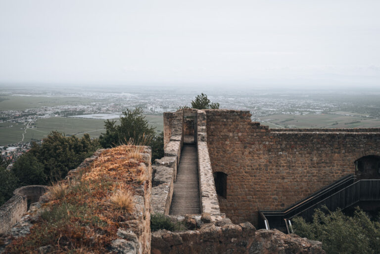
If you only do one castle hike near Colmar, this would be one of my top picks because the views feel bigger and the trail is usually quieter than people expect.
The Hohlandsbourg Castle is also one of the largest fortified castles in Alsace, so you get history, culture, and nature all in one place.
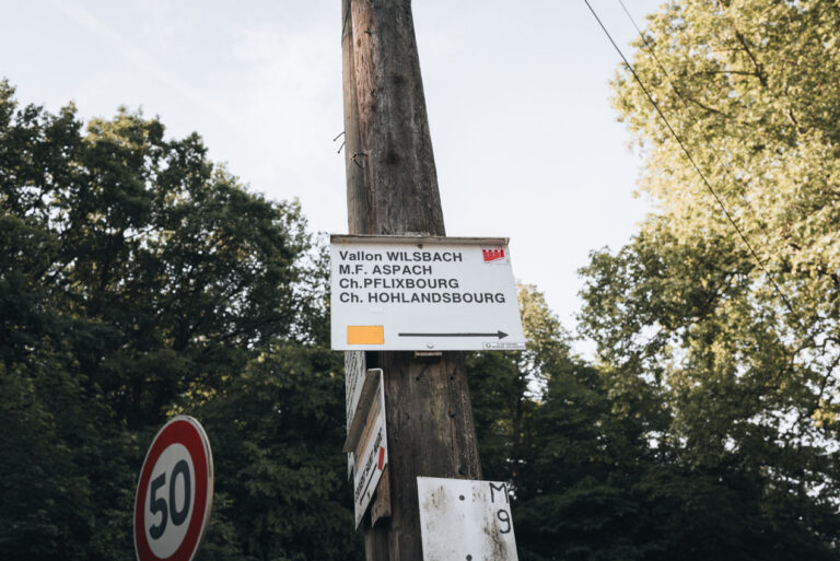
The official trail starts at the St. Gilles bus stop in Wintzenheim, where you’ll see two signs.
I recommend following the yellow rectangle sign up and down because it’s better labeled.
The map I included shows a mix of the two possible routes (the yellow rectangle trail up and the red triangle route down).
Helpful Tip: The red rectangle route changes symbols and colors throughout the trail. If you decide to follow this route, make sure to look for the word Château du Hohlandsbourg on the way up and St. Giles on the way down.
Along the yellow rectangle route, there’s also the option to stop at the Plixbourg Castle.
I will admit that this castle isn’t the most impressive. It’s in ruins, but still, the history is cool, so I always stop by just to snap a few photos. If you don’t have time, I recommend skipping it.
In general, there are sections with small accents and descents, but nothing extreme.
I’ve done this hike a few times, and I always have a bottle of water and some snacks because the full route is long, especially if you walk from Turckheim.
4. Haut-Barr Castle
- Difficulty Level: Moderate
- Starting point: 88 Rue du Haut Barr, 67700 Saverne (near Hôtel La Garenne)
- Highest Point: 428 meters (1404 feet)
- My Time: 1 hour 30 minutes
- Route length: 4.2 kilometers (2.6 miles)
- Accessible by Public Transport: Yes
- Google Map
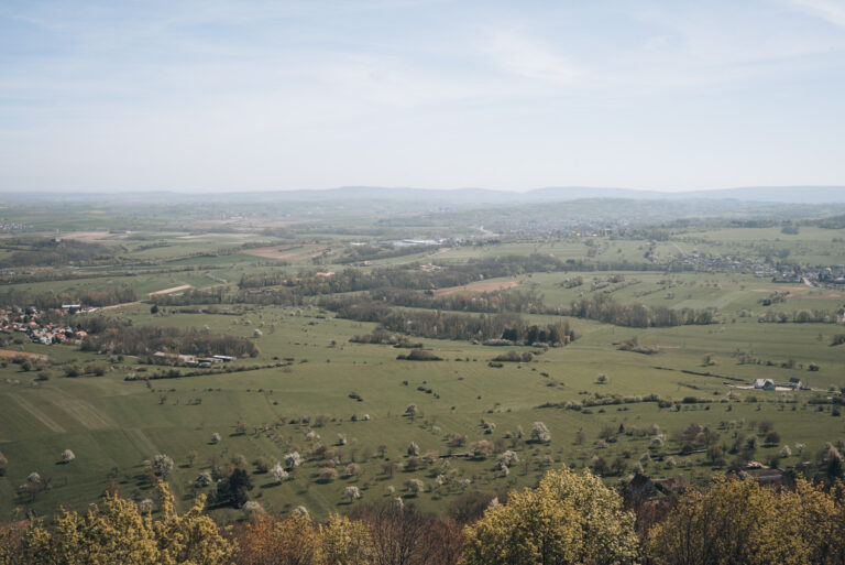
The Haut-Barr Castle, otherwise known as the eye of Alsace, offers some of the best views of the region from its top terrace.
What I like about this hike is that it’s easy to do in half a day and can be combined with a visit to Saverne.
The official hike starts at Hôtel La Garenne, but, since I don’t have a car, I always start downtown Saverne and walk to the starting point.
If you start from downtown Saverne, the first marker is along Quai de l’École, and from there it’s a slightly uphill walk to Hôtel La Garenne.
From Hôtel La Garenne, the trail is well-marked with some gradual inclines along the way.
Once you reach the Haut-Barr Castle, you’ll find several terraces with beautiful views, the best being from the Devil’s Bridge.
It’s a vertigo-inducing climb up a small set of stairs, and, if you’re like me and don’t like heights, it feels much more intense than the rest of the route.
On my first visit, it took me 30 minutes to convince myself to go up.
There’s also a restaurant at the top, but it has limited opening hours, so I always bring water and some snacks.
5. Three Castles of Ribeauvillé
- Difficulty Level: Moderate
- Starting point: 2 Rte de Sainte-Marie aux Mines, 68150 Ribeauvillé (near Restaurant Aux Trois Châteaux)
- Highest Point: 648 meters (2125 feet)
- My Time: 3 hours 30 minutes
- Route length: 8.0 kilometers (4.9 miles)
- Accessible by Public Transport: Yes
- Google Map
Helpful Tip: I’ve shown this hike as a loop, but if you’re short on time, you can take the same trail down.
This is one of my favorite activities in Ribeauvillé, and is probably my favorite castle hike in the region because the effort-to-reward ratio is so good.
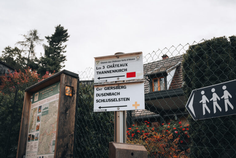
The trail starts next to the Restaurant Aux Trois Châteaux and is well-signposted to the top.
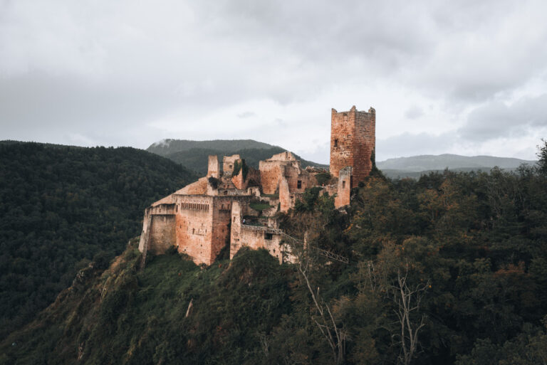
On the way up, you’ll reach a fork in the trail to a fork with two signs: one for Château du Girsberg and another for Château de Saint-Ulrich.
The path to Château du Girsberg is a steep dirt trail. The route to Château de Saint-Ulrich has a more gradual incline but includes a rocky section with large boulders.
I’ve tried both and prefer the path to Château de Saint-Ulrich. It’s much easier, and there are handrails and ropes to help you get over the boulders, although I didn’t need them.
Once at the top, a flat trail connects all three castles.
After exploring, you can go down the same way you came up or continue on the Three Castles of Ribeauvillé trail behind Château du Haut-Ribeaupierre.
Helpful Tip: Make sure to follow the signs pointing to Ribeauvillé.
This path winds through the vineyards and ends in the town center.
When I hiked the full loop, it took me about 3.5 hours because I stopped to visit the castles and take photos.
Helpful Tip: Château du Haut-Ribeaupierre is currently closed for restoration, so you can’t go inside.
6. Grand Ballon Panorama Tour
- Difficulty Level: Easy
- Starting point: Parking Lot – Col du Grand Ballon
- Highest Point: 1422 meters (4665 feet)
- My Time: 1 hour 30 minutes
- Route length: 2.8 kilometers (1.7 miles)
- Accessible by Public Transport: No
- Google Map
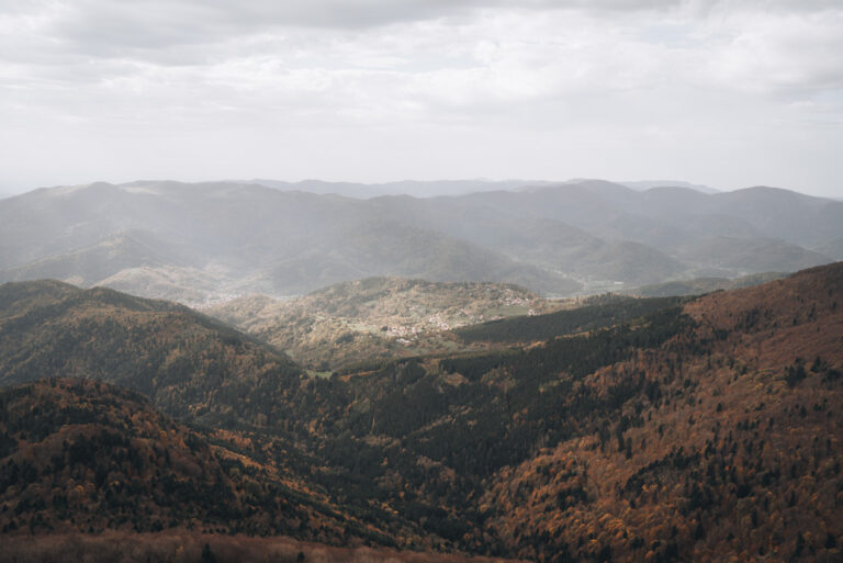
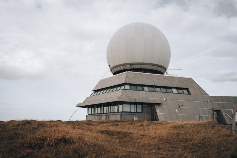
Grand Ballon is the highest peak in the Vosges, but the reason I keep coming back is how easy this loop makes it to get wide-open views.
I have hiked to the Grand Ballon from Guebwiller and Vieux-Thann, but those were very long hikes that aren’t doable if you’re visiting Alsace for only a few days.
So, as an alternative, I recommend hiking the Grand Ballon Panorama Tour.
The trail goes around the summit and is well-marked. There are only slight inclines and no obstacles along the route.
This isn’t the wildest hike on the list, but it’s one of the easiest ways to get those broad Vosges views without committing to a long climb.
7. Lac Blanc and Lac Noir Tour
- Difficulty Level: Difficult
- Starting point: Parking Lot at the Auberge du Lac Blanc
- Highest Point: 1251 meters (4104 feet)
- My Time: 4 hours 30 minutes
- Route length: 9.3 kilometers (5.7 miles)
- Accessible by Public Transport: No
- Google Map
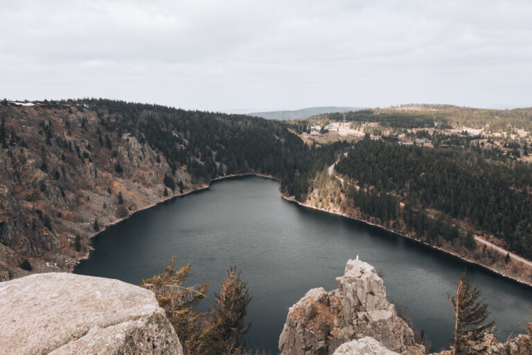
Lac Blanc is one of the most stunning lakes in Alsace, but you should not underestimate the trail that loops around it.
While the total mileage looks entirely manageable on paper, I can tell you from experience that this route is harder than you might expect.
The path connecting Lac Blanc and Lac Noir forces you to navigate steep inclines and uneven, rocky footing.
You will absolutely earn your views here, especially when you finally reach the Observatoire Belmont to look down over the water.
It is a fantastic route, but you must prepare for a genuine physical effort rather than a casual lakeside stroll.
The weather also plays a massive role in how difficult this terrain gets.
When I first tackled this hike in late March, thick patches of snow and ice still covered the shady sections of the trail, and I slipped more than a few times.
If you plan to visit in the early spring, always check the local webcams before you head out so lingering winter conditions do not catch you off guard.
8. Mont Sainte-Odile
- Difficulty Level: Moderate/Athletic
- Starting point: Parking Lot next to Église d’Ottrott
- Highest Point: 764 meters (2506 feet)
- My Time: 5 hours
- Route length: 10.4 kilometers (6.4 miles)
- Accessible by Public Transport: Yes
- Google Map
My very first hike in Alsace was to Mont Sainte-Odile, and it remains one of my absolute favorites today.
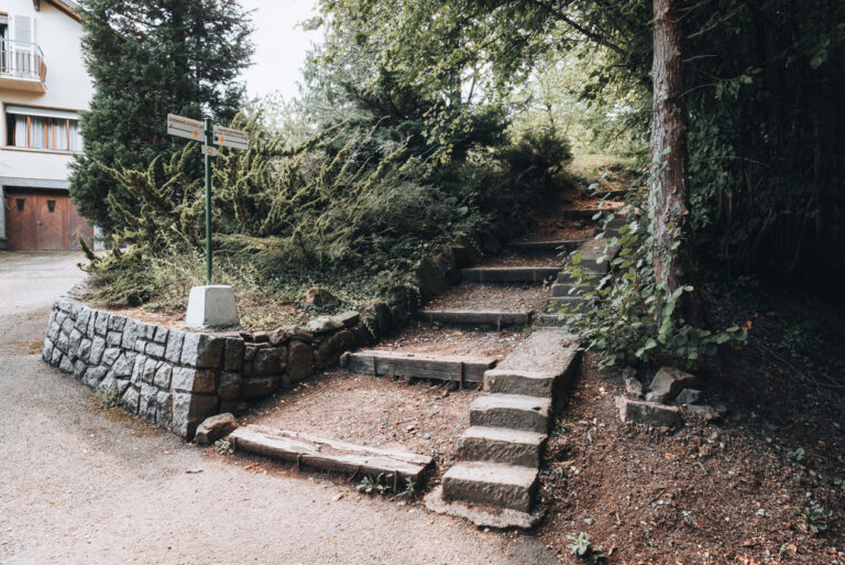
The trail starting from Ottrott climbs steadily through the Vosges, offering a perfect mix of quiet forest paths, fascinating rock formations, and sweeping viewpoints along the way.
What sets this hike apart from every other route on this list is how the experience shifts as you walk.
You get the ruggedness of a traditional forest trail, but the final reward is cultural rather than just a natural summit.
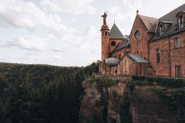
Arriving at a stunning, historic monastery perched on a rocky cliff above the plain feels unique.
Once you reach the top, you can walk along the outdoor terraces for a massive panorama of the Alsatian countryside.
Take a few minutes to step inside the monastery itself to explore the chapel and the tomb of Alsace’s patron saint.
If you want to skip the downhill trek, you can easily catch a seasonal bus directly from the summit back toward Obernai or Strasbourg.
What to Know Before You Go
Here are a few things you should know before you set out on a hike in this part of France.
- Best time to hike: Spring and fall are perfect for walking through the vineyards, while summer is the best season to tackle the higher routes in the Vosges.
- Difficulty: Most paths are highly accessible and moderate, but remember that reaching a castle almost always requires an uphill climb.
- Public transport: You can reach several great trailheads by bus or train, though a car makes it much easier to explore the deeper mountain routes.
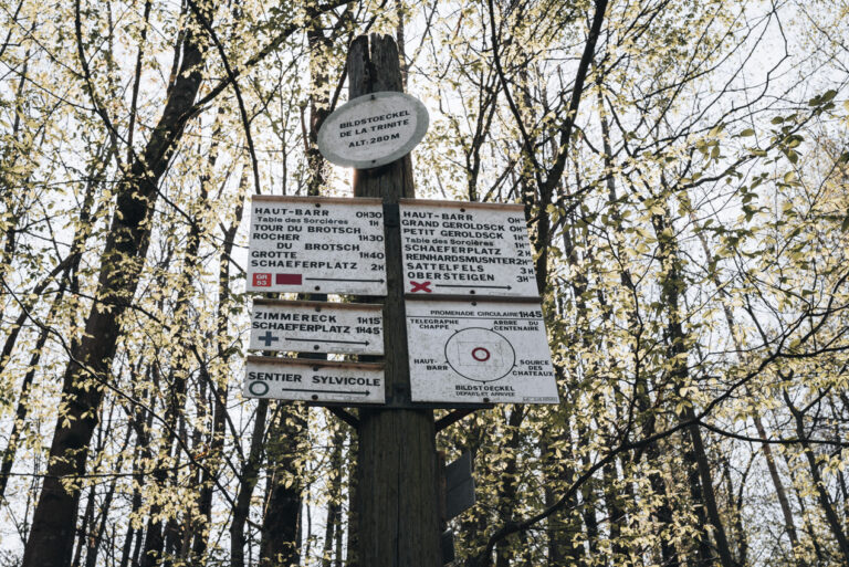
- Trail markings: Trails are generally well marked by Club Vosgien using colored symbols rather than trail names.
- Weather: Conditions can change rapidly, so always check the local forecast.
- Shoes: I always wear comfortable trail runners with a reliable grip, which handle everything perfectly unless you encounter winter ice.
- What to bring: Always pack plenty of water, a few snacks, a light rain jacket, and your phone with offline maps downloaded, since cell service frequently drops in the forest.
Summary
I have listed my absolute favorite trails, but you certainly do not need to tackle all of them on one trip.
To help you narrow it down, here is my honest, bottom-line take on exactly which route you should choose.
- For first-time visitors: If you only have time for one hike, make it the Three Castles of Ribeauvillé. It delivers the perfect classic Alsace experience with vineyard views, medieval ruins, and a highly rewarding climb.
- For an easy stroll: If you want maximum scenery with minimal physical strain, the path from Ribeauvillé to Riquewihr is unbeatable. (Though if you happen to visit in mid-April, do the Circuit des Cerisiers instead for the blossoms).
- For the best castle views: Hohlandsbourg Castle is my top recommendation if you are based in Colmar and want massive, sweeping panoramas without fighting huge crowds.
- For a physical challenge: Head straight for the Lac Blanc and Lac Noir Tour. You will definitely earn your views on those steep, rocky Vosges inclines.
Ultimately, there is no wrong path here; pick the trail that best fits your personal travel style and the amount of time you have to explore. I’ve written tons of guides about visiting Alsace, so you’ll be able to plan the perfect trip.
Read More Articles About Alsace
I hope you enjoyed my post and found it helpful. Here are some other articles that I think you might find interesting.
- 25 Amazing Things to Do in Alsace (Local’s Guide)
- Alsace without a Car: Top 19 Things to Do (from a Local)
- 19 Most Charming Towns in Alsace (Local’s Guide)
- A Local’s Guide to Getting Around Alsace
